Cave survey software
CaveWhere is cave survey software with an intuitive design that enables building and visualizing underground cave maps. Using its advanced 3D engine, CaveWhere automatically morphs your 2D cave survey notes in 3D. Loop closures re-morph affected scan scraps automatically so your cave map is always up-to-date. With CaveWhere survey-book data entry, quickly enter your cave survey or import it from other cave survey software such as: Walls, Survex, or Compass. Once you have a quick working cave map, export it! CaveWhere, being a cave mapping app, fills the step between cave survey and drawing the final map in Illustrator or Inkscape. CaveWhere can export hi-resolution cave maps to PNG, JPG, SVG, or PDF. Start using CaveWhere by downloading it.
The Process
1. Survey Cave!
Hopefully it goes. CaveWhere loves big caves, but it handles small ones too.


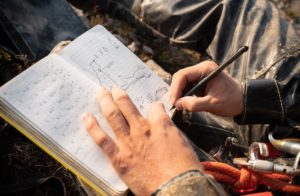
2. Enter Data
Using CaveWhere’s survey entry tool, scan your notes and enter data directly. Carpet your scraps by drawing a polygon and clicking survey stations.
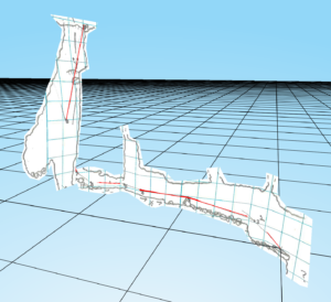
3. Visualize
Render the map in 3D viewer. CaveWhere visualizes both plan and profile maps in the same 3D renderer.
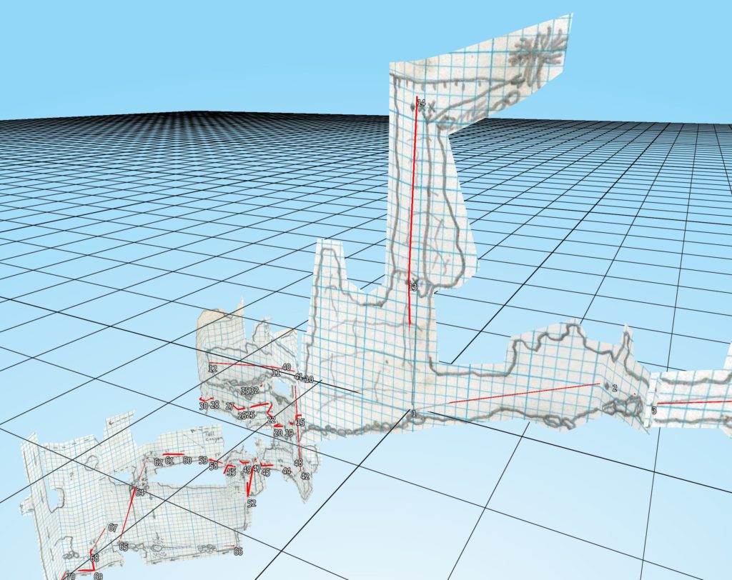
Quick Working Cave Maps
Is your cartographer too slow?
As a cave mapping app, CaveWhere can produce hi-resolution working cave map in seconds. Using tile based rendering algorithm, CaveWhere can render to any paper-size at any resolution. This means you can export large areas at high resolution in a image, PDF or SVG file. Since CaveWhere renders the cave map in 3D, any perspective can be exported. Standard cave map views includes plan, projected profiles (from any angle) and oblique. When using multiple views together, CaveWhere automatically scales and lines up profile and plan views. Checkout this video on creating quick working maps.

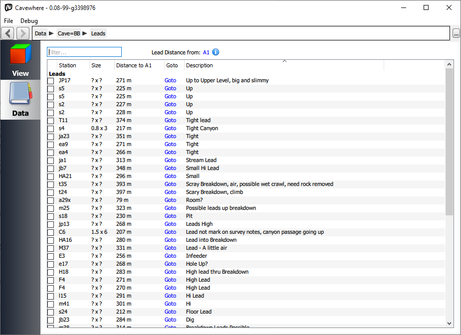

Lead List
Explore it all
Most cave maps are used for future exploration. As a cave survey software, CaveWhere can help with that. With CaveWhere’s lead list, never lose a lead. Leads can be listed and sorted, by dimension, description and distance to a station. Since CaveWhere is a cave mapping app, it also visualizes the leads in 3D and they can be easily hidden when completed. Check out this tutorial on lead lists.
Visualize Running Profiles
Create Profile Maps Easily
Without CaveWhere, creating profile maps is hard. Cartographers have to manually warp each survey shot in the sketch when drawing a 2D cave map. CaveWhere pushes the limits of cave mapping software by automatically warping and wrapping running profiles to the cave survey’s centerline. CaveWhere’s 3D engine renders your running profiles in real-time and gives you a unique view of your cave. Just like plan sketches, CaveWhere can export your running profiles at any azimuth or angle to give you projected profile. Checkout the tutorials on creating profile maps.